Skip to content

Hiking With Cloud Whisperer

“You’re off to great places, today is your day. Your mountain is waiting, so get on your way.” ~Dr. Seuss

  • Home
  • All About Me
  • Hiking Adventures
    • 2020 Pinhoti Trail Section Hike
      • Pinhoti Section Hike Planning
      • Pinhoti Trail Gear
  • Bikepacking Adventures
    • 2022 Longleaf Trace
      • Longleaf Trace Gear
    • 2022 Natchez Trace Section
  • Contact
  • Instagram
  • YouTube

Author: Cloud Whisperer

2022 Natchez Trace Section

Posted on February 8, 2022February 8, 2022 by Cloud Whisperer

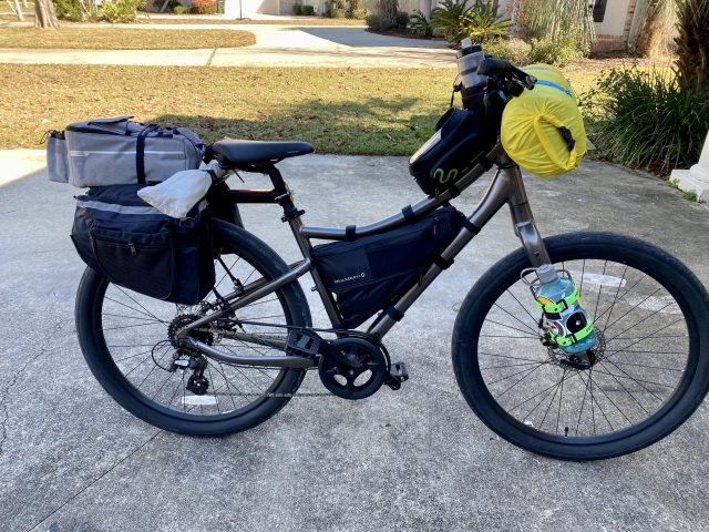
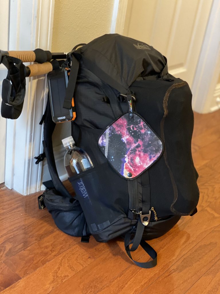
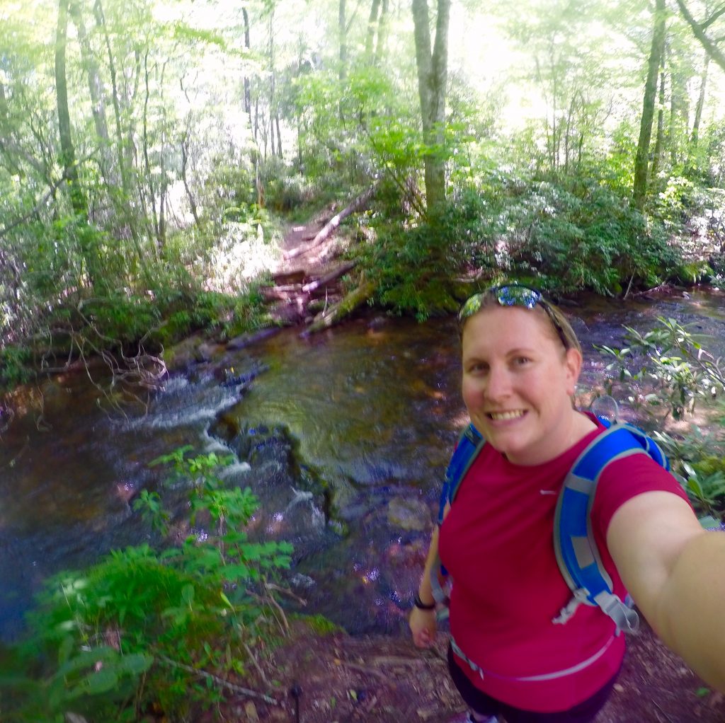
I found myself with a long weekend to get back out on the trail after my first bikepacking trip and I have decided to hit up a section of the Natchez Trace, as it is a long distance biking area within a few hours of me, and additionally has the benefit of designated campgrounds along my journey.

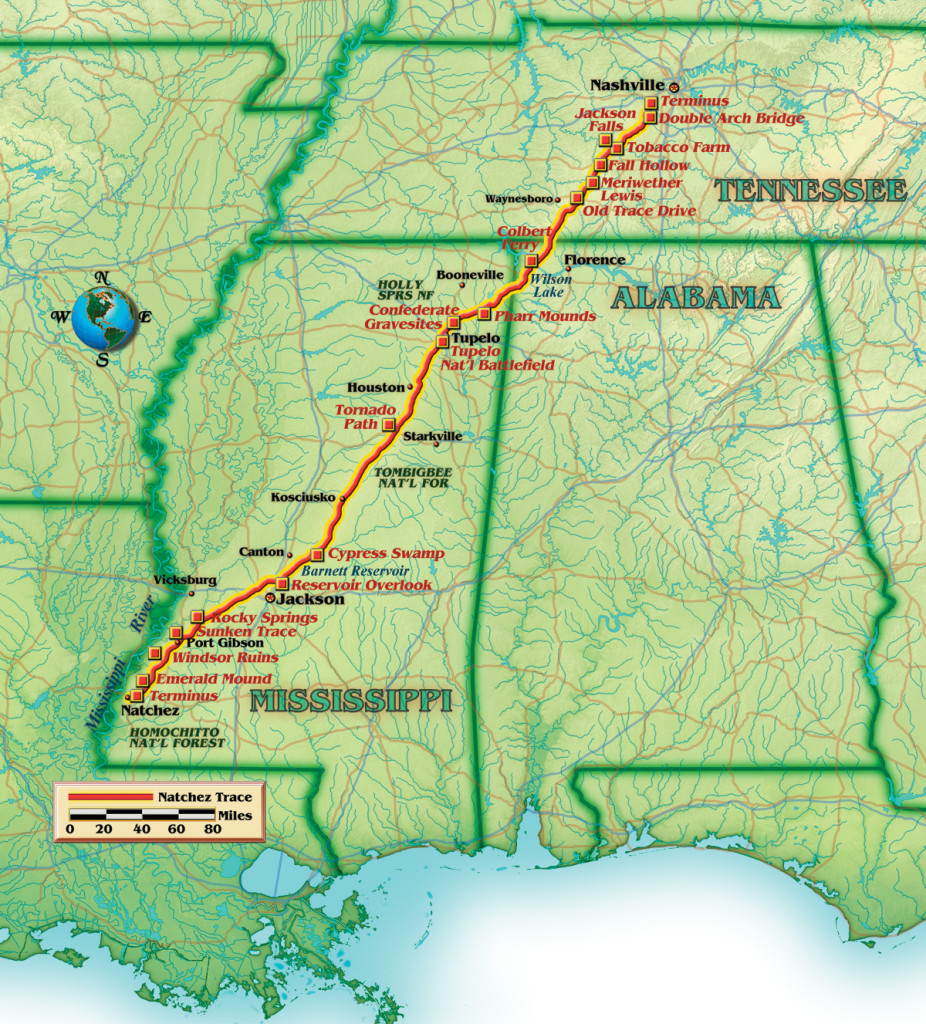
The Natchez Trace Parkway is a 444-mile recreational road and scenic drive through three states (Tennessee, Alabama, and Mississippi). It roughly follows the “Old Natchez Trace” a historic travel corridor created and used by Native Americans for centuries, and was later used by early European and American explorers, traders, and emigrants in the late 18th and early 19th centuries. Today, the Parkway has been declared a National Scenic Byway and an All-American Road, and has been chosen as one of America’s 10 best biking roads. It is open year-round for motorists, hikers and bikers.

It was established as a unit of the National Park System in 1938 and officially completed in 2005, the Parkway is currently headquartered in Tupelo, Mississippi and continues to be maintained and administered by NPS.

Natchez Trace- Natchez, MS to Nashville, TN

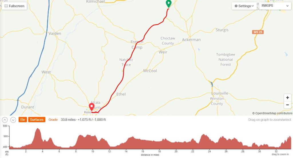
For my upcoming trip, I am going to do an out and back section from Jeff Busby Campground (MM 193) and head south to Kosciusko Bicycle Campground (MM 159) for a total of 66.8 miles for the trip over two days. I chose this section of the trail for the proximity of designated campgrounds in between a distance that I knew that I could do (abide this will be my longest stretch of riding over two days). However, the interesting thing about this ride is it’s on a roadway- meaning there will be vehicle traffic (speed limit is capped to 50 mph), so unlike my last trip, I will be sharing the road with cars. I plan on biking in high visibility colors and will have my rear flasher on. My route will take me past the town of French Camp (MM 180), which will provide a nice stop for a late breakfast or lunch and a water fill-up. Additionally, I will pass by the Bethel Mission picnic area (MM 176) which will give me a safe spot to take a break if needed. Otherwise, MM 176-159 will have no other provisions until I arrive at camp.

Out and Back Route from MM 193 to MM 159

Other Camping Information about the Natchez Trace:

  • The Natchez Trace Parkway manages three campgrounds along the length of the 444-mile Parkway. The three Parkway campgrounds are free, primitive, and available on a first come, first serve basis. (https://www.nps.gov/natr/planyourvisit/camping.htm)
  • There are five bicycle only campgrounds. Each Parkway campground provides tent sites, picnic tables, and fire grates throughout the year. Water is available throughout the year inside Parkway restrooms; outside water sources may be unavailable during winter months. (https://www.nps.gov/natr/planyourvisit/bicycle-only-campgrounds.htm)

Resources in my planning process:

  • Received a bicycle packet with NPS for free via: Email us and specify “Bike Packet” Please note that mail will be sent out once a week. Or calling 662-680-4027.
  • https://www.nps.gov/natr/index.htm
  • https://www.natcheztracetravel.com/
  • https://www.scenictrace.com/

Posted in UncategorizedLeave a Comment on 2022 Natchez Trace Section

Longleaf Trace Gear

Posted on January 11, 2022January 13, 2022 by Cloud Whisperer
Longleaf Trace Gear

Bike Details:

  • Bike: Momentum Vida
  • Headlight/Taillight: Akale USB Rechargeable Bike Lights Set
  • Rear Bike Cargo Rack: 110Lb Capacity Bike Cargo Rack
  • Side Rear Bags: 20L Bicycle Rear Seat Bag
  • Top Rear Bags: ZIMFANQI Bicycle Rack Rear Carrier Bag
  • Handlebar Feeding Bag: kemimoto Bike Cup Holder
  • Tank Bag: ROCKBROS Bike Frame Bag
  • Frame Bag: Blackburn Outpost Bike Frame Bag (Medium)
  • Repair Kit: 16 in 1 Bike Repair Tool / Mini Bike Pump

Gear:

  • Tent (Split Between 2 people): Ozark Trail 2 Person Lightweight Backpacking Tent
  • Sleeping Bag: Ozark Trail 40F Climatic Cool Weather Sleeping Bag
  • Sleeping Pad: POWERLIX Sleeping Pad
  • Pillow: TREKOLOGY Ultralight Inflating Pillow
  • Cook System: BRS Mini Stove / Snow Peak Trek 700 Titanium Pot / Snow Peak Hot Lips / Snow Peak Titanium Spork / Silicon Collapsible Cup
  • Camping Chair: Esup Camping Chairs
  • Hygiene Kit: Deuce Ultralight Backpacking Potty Trowel / GoGirl / Kula Cloth / other hygiene items
  • Electronics: Garmin 530 Edge

**DISCLAIMER: This page contains affiliate links. This means that if you click on one of the product links and buy something, I will receive a small commission at no extra cost to you. Thank You! **

Posted in Gear, PlanningTagged bike, bikepacking, gear, planningLeave a Comment on Longleaf Trace Gear

2022 Longleaf Trace

Posted on December 16, 2021January 2, 2022 by Cloud Whisperer

Kicking off my bikepacking adventure with the Longleaf Trace- located in Southern Mississippi. I wanted to start out with this one since: it is the closest trail to my home, it’s fully paved, had established campgrounds on the route (to include one that can only be reached via bike), and has several amenities to assist.

I didn’t want to get too ahead of myself getting into something new, so I liked the idea of testing this out where I was close to home and could be bailed out if needed and to fully learn how my bike will perform and my athletic ability by starting on a paved road.

Longleaf Trace

The Longleaf Trace was completed as a Rails-to-Trails conservancy project in 2000, erected along a portion of the abandoned line of the Mississippi Central Railroad. Beginning at the gateway in Hattiesburg near The University of Southern Mississippi, the Longleaf Trace traverses through five communities for 44 miles. Source: https://www.longleaftrace.org/history-of-the-trace

Map of the Longleaf Trace
More Details

Our intention is to complete the 44 miles over the span of two days. Starting at the southern end in Hattiesburg, camping near the Carson Station, and finishing out the next day at the northern end at the Carolyn McRaney Trailhead. We will be staging a vehicle at either end.

Stay tuned to how we will get our bikes set up to carry our camping gear!

Posted in UncategorizedTagged bikepacking, longleaf trace, maps, mississippi, planningLeave a Comment on 2022 Longleaf Trace

Pinhoti Trail Gear

Posted on July 28, 2020August 2, 2020 by Cloud Whisperer

I made a separate tab for a quick reference to my gear for the time being, as I, but I wanted to type out a bit more of my gear planning, purchasing, and packing process.

Still being a novice, I did have a few items already that I will be using for this hike, but a vast majority of the gear listed are items purchased specifically to do this hike, but it will at least give me a starting point for other backpacking trips in the future.

To comply your own detailed list of gear and the associated weight, check out this nifty website, Packfire. Total FULL Weight: ~25lbs.

My Pinhoti Trail Pack.

I will talk about my food/water storage and plans in a separate post.


Big 3 (Pack, Shelter, Sleep)

I already had the pack, shelter, and sleeping bag from previous trips. It’s not the lightest gear, but wasn’t going to drop several hundred dollars on new gear, when I could make due with what I already had.

  • Pack: REI Co-Op 40L ; Pack Liner: Gossamer Waterproof Pack Liners
  • Shelter: Ozark Trail 2-Person 4-Season Tent (Items/weight will be split between us) Footprint: Dakout Ultralight Backpacking Tarp
  • Sleep: Ozark Trail 40F Sleeping Bag ; Pillow: TREKOLOGY Aluft 1.0 ; Sleeping Pad: POWERLIX Sleeping Pad
  • Total Weight: 10.29 lbs
Sleep System / System, extra clothing, footprint, rain fly of tent; all stored in one bag

Clothing

Weather is going to be very hot, humid and buggy. I really don’t like wearing pants to perform any outdoor activity. I’d rather go with higher socks/gaiters with shorts. Additionally, I prefer trail running shoes, as they’re lighter weight over standard hiking boots.

Wearing: Women’s Insect Shield S/S Tech Tee, Columbia Women’s Sandy River Cargo Shorts, YUEDGE Women’s Hiking Socks, Dirty Girl Gaiters, Merrell Siren 3 Vent Hiking Shoes, Buff, ExOfficio Underwear

Packing: Under Armour Heat Gear S/S, Columbia Heather Long Sleeve, Rei Co-Op 5″ Shorts, One extra pair of socks and underwear. (Stored in the bottom of the sleeping bag)

Rain Gear: Columbia Jacket (Will be placed in the top of the main compartment of the pack)


DITY Bag Items

This will include my first aid kit, medication, repair kit, and other health/comfort items. Will be stored in small dry bag.

Hygiene Items: GoGirl, Kula Cloth, Combat Wipes, Campsuds Soap, Travel Toothbrush, Toothpaste, hand sanitizer, Picaridin Insect Repellent Wipes, Travel Sunscreen.

First Aid Items: daily medication, daily vitamin, ibuprofen, leukotape, alcohol wipes

Repair Kit: Patches from sleeping pad, pillow, duct tape (wrapped around trekking pole), BIC mini lighter


Miscellaneous

This will include other items that I’m bringing along either “just in case” or extra comfort items.

  • Trekking Poles
  • Ultralight Camp Chair
  • Solar Charger 20000mAh YOESOID
  • GoPro Hero 7 Black (extra batteries)
  • iPhone 11 Pro (w/ cable, case, and headphones)
Posted in Gear, PlanningTagged amazing, backpacking, gear, ozark trail, reiLeave a Comment on Pinhoti Trail Gear

Pinhoti Section Hike Planning

Posted on July 27, 2020July 29, 2020 by Cloud Whisperer

This was my first endeavor of planning a section hike from “scratch”. What I mean by that is I didn’t use a pre-planned route like I have in past (Example: SNP Backcountry Trips). We decided that we wanted to do a section hike instead of a out and back hike or circuit hike. That way we were getting to do more of the trail without backtracking over the same area. However, with starting and ending at different points brings up different logistical planing.

Below are several resources that I used to plan and read up about this trail:

  • Pinhoti Trail Alliance (This was a huge resource for me to show the different sections. However, it has been designed in such a format that it is difficult to read)
  • Pinhoti 2014 Trail Map/Waypoints
  • Guthook Guides (This app has been downloaded to my phone and will be my main source of mapping on the trail)
  • Darwin OntheTrail 2018 Pinhoti Trail Thru-hike
    • Thru-Hike YouTube Videos
  • Whitewater’s Pinhoti 2016 Thru-hike Journal
  • Greenbelly Planning Your Thru-hike 101- Pinhoti
  • Alabama Hiking Trail Society- Pinhoti Trail
  • Pinhoti Trail Alliance Facebook Group

Once I had an overall sense of the trail, read and watched as much as I could, I decided that going for an average of 10 miles a day for the 5 days that I had would be a good feasible goal. Being this my first time in attempting a multi day trip, the heat, and how much shape I know I’m in, I didn’t want to over shoot the mileage.

Next, step came “Which 50-60 miles should I do?” and that answer came through asking some questions on the Facebook page and reading through multi people’s trail journals to see what their highlights of the trail were. Nearly every thing I saw lead me to the Cheaha State Park area, which are in sections 6 & 7, so throwing section 5 on the front end and section 8 on the back end gave me a total of 53.9 miles.

Pinhoti Section Hike Map
Pinhoti Sections 5-8
Daily Plan

Posted in PlanningTagged hiking, maps, planningLeave a Comment on Pinhoti Section Hike Planning

2020 Pinhoti Trail Section Hike

Posted on July 26, 2020December 28, 2021 by Cloud Whisperer
Pinhoti Trail Blaze

The Pinhoti Trail is a long-distance trail, 335 miles long, located in the states of Alabama (171 miles) and Georgia (164 miles). The trail’s southern terminus is on Flagg Mountain, near Weogufka, Alabama, the southernmost peak in the state that rises over 1,000 feet. The trail’s northern terminus is where it joins the Benton MacKaye Trail in Georgia.

Pinhoti Trail Map https://www.conservationfund.org/projects/connecting-pinhoti-and-appalachian-trails

The Pinhoti Trail is divided up into 31 sections, with 13 sections located in Alabama and 18 sections located in Georgia. We have a five day window coming up in early August 2020 and are planning on hiking sections 5 through 8 in Alabama (see below). This distance will cover 53.9 miles from Porter’s Gap to FS 500.

Sections 5 – 8: 53.8 miles on the Pinhoti Trail.

We have chosen to do that particular section as the area surrounding Cheaha State Park is considered some of the most beautiful scenery on the trail, there are a decent amount of streams/water sources in these sections (which is even more critical with the summer heat), higher elevation (cooler temps and mountain scenery), and a decent amount of campsite opportunities (perfect for us novices). So, with only a short window to get out backpacking, we wanted to see all with can, being as safe a possible, and getting our novice feet wet into the backpacking world.

In the following posts I plan on going through the trip planning process, gear list/packing, and then the trail itself.

Posted in AnnouncementLeave a Comment on 2020 Pinhoti Trail Section Hike

Welcome to My Blog!!!

Posted on July 23, 2020July 28, 2020 by Cloud Whisperer

Greetings and Salutations! Welcome to my hiking blog. My intention is to share my adventures of hiking, camping, backpacking and/or anything else outdoorsy that I find myself getting into.

I’ve been fascinated about hiking, camping, and backpacking since my early 20’s. I didn’t grown up in the outdoors, so it was a very foreign world for me to learn about and it just sounded like an amazing adventure.

I’ve actively read all I could get my hands on and added to my bucket list a full thru hike of the Appalachian Trail once I was retired from the military. However, in all of my reading, most people to attempt something like this are young and fit. Being in my mid 30’s and overweight, it was something that almost felt unachievable. That thought alone drives me to want to hike more- my way. That you don’t need to be a young, the most in shape, or have all the outdoor skills to enjoy nature.

Posted in UncategorizedLeave a Comment on Welcome to My Blog!!!

Recent Posts

  • 2022 Natchez Trace Section February 8, 2022
  • Longleaf Trace Gear January 11, 2022
  • 2022 Longleaf Trace December 16, 2021
  • Pinhoti Trail Gear July 28, 2020
  • Pinhoti Section Hike Planning July 27, 2020

Recent Comments

    • Home
    • All About Me
    • Hiking Adventures
      • 2020 Pinhoti Trail Section Hike
        • Pinhoti Section Hike Planning
        • Pinhoti Trail Gear
    • Bikepacking Adventures
      • 2022 Longleaf Trace
        • Longleaf Trace Gear
      • 2022 Natchez Trace Section
    • Contact
    • Instagram
    • YouTube
    Back to top
    Proudly powered by WordPress | Theme: sylvan by Saunders Technology.